

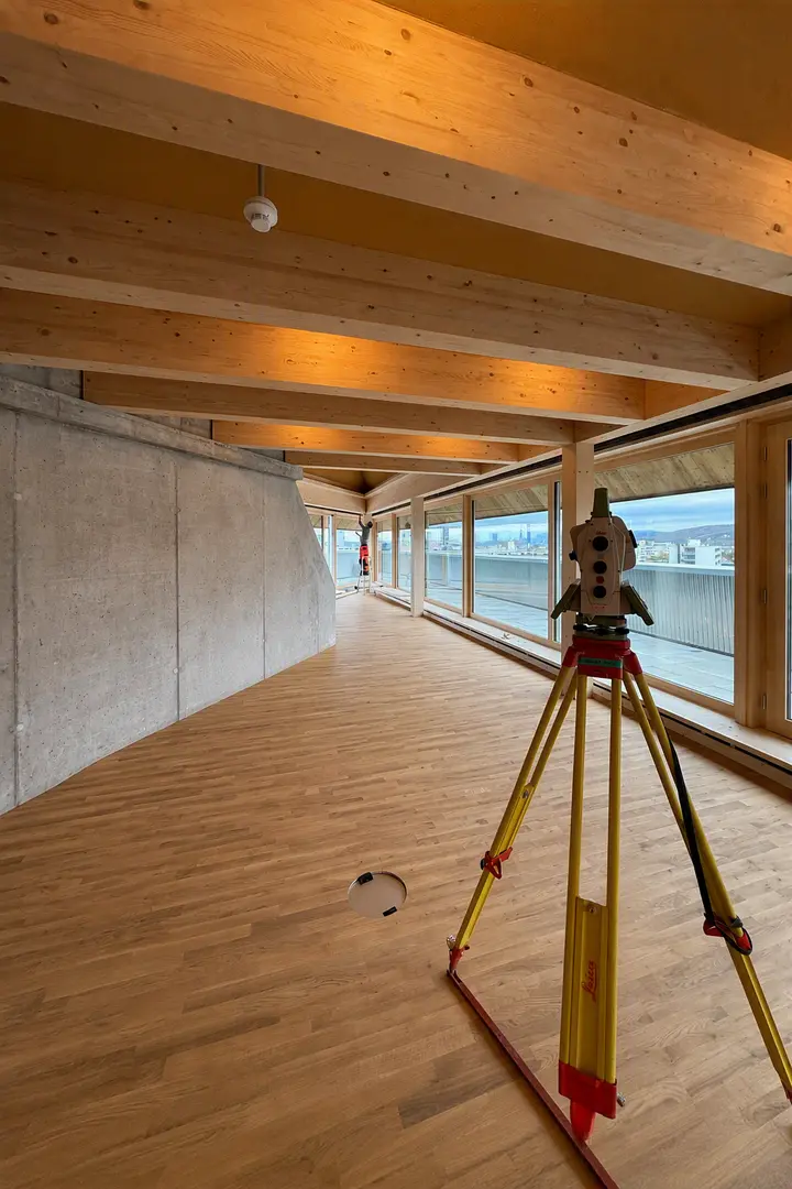
Whether private clients, industrial companies or the public sector: reliable survey data provides a clear picture of the actual situation.
Rapp collects, verifies and organises geospatial data so that it can be used for the specific task and for further planning.
|
Services
|
Up-to-date inventory data provides planning certainty for refurbishments, expansions and ongoing operations. You will receive verified baseline data that accurately reflects the actual inventory and can be used directly.
Rapp approach We tailor the accuracy, level of detail and data structure to the task at hand. Depending on the project, we combine terrestrial surveying methods with drone imagery and process the results into CAD, GIS or BIM data. |
|
Services
|
Large, hard-to-reach or sensitive areas are surveyed quickly, safely and cost-effectively.
Rapp approach Rapp combines drone imagery with terrestrial surveying and professional quality control. This produces not only impressive images, but also verified geospatial data for planning, GIS, BIM, documentation and volume calculations. |
|
Services
|
To ensure that the actual work carried out corresponds to the plans, precise specifications and checks are required throughout the construction process. Deviations are detected at an early stage and the process can be controlled on a reliable geometric basis.
Rapp approach Rapp combines surveying with expertise in building construction, civil engineering and complex infrastructure projects. Surveying concepts, marking and checks are coordinated with the construction schedule and specialist planning. |
|
Services
|
Railway infrastructure places high demands on accuracy, safety and an understanding of operational framework conditions. Accurate geospatial data provides certainty for the planning, construction, maintenance and operation of railway infrastructure.
Rapp approach Specialists with railway-specific training combine surveying skills with expertise in railway infrastructure, civil engineering and operations. Operational guidelines and safety requirements are taken into account in the measurement planning. |
|
Services
|
In the case of a tunnel structure, its geometry, condition and any changes must remain precisely traceable throughout all project phases. Measurements form part of a building’s life cycle, from the initial survey through to construction, monitoring and operation. They document the progress of the construction work and lay the foundations for tracking changes and deviations over the long term.
Rapp approach Rapp combines specialist tunnel surveying with expertise in tunnel construction, civil engineering, monitoring and digital documentation. The measurement task is tailored to construction methods, risks, safety and operations. |
|
Services
|
Safety comes from knowledge, not from assumptions. Repeated measurements show whether and how structures or their surroundings are changing. Movements and changes are identified at an early stage and assessed in a clear, understandable manner. This ensures control over complex construction and infrastructure projects.
Rapp approach Rapp develops a measurement framework, assessment criteria, evaluation methods and information channels based on the actual project risks, and coordinates the results with the agencies involved. |
|
Services
|
Before work begins on a building project, clear and comprehensive documentation provides clarity on the existing condition. The condition of the buildings, facilities and surrounding area has been objectively documented. This makes it possible to track changes and incidents in a clear, transparent manner.
Rapp approach We select the method and level of detail to suit the construction method, the surrounding environment and the project risk. Images, survey reports and existing condition information are compiled to form comprehensive documentation. |
What expertise does Rapp have in conducting surveys?
Rapp has a wealth of expertise in construction, engineering and industrial surveying. Our staff support projects from design to final acceptance.
You can rely on our comprehensive knowledge and skills in the various and complex areas of surveying. In particular, we have exceptional expertise in the urban environment. State-of-the-art surveying instruments guarantee a smooth and precise workflow. By this means, we obtain precise data – an issue of great importance in every individual project.
Detailed surveying data compiled by a professional surveying office is indispensable in advance of construction projects. This applies not only to new builds, but also to conversions and interior works.
One method used here is 3D laser scanning, a modern technology which enables us to carry out a three-dimensional survey in a very short time. It can be used to survey rooms, façades and entire buildings as well as pipelines and tunnels. The images can be used for later analysis if further information is required.
We carry out topographical surveys using drone flights, among other means. Photos are taken from the air without affecting ongoing operations. This method is therefore of particular interest for construction sites and traffic systems.
The images produced by drones are high resolution and can therefore be used for a variety of purposes, including creating 3D surface models or measuring specific masses.Contact us for more information.
How is the surveying data digitally processed and analysed?
In addition to many other services, Rapp is also a specialist in surveying. Our team uses a variety of methods to conduct surveys in the following areas:
- Construction and engineering surveys
- Topographical imaging
- Industrial, plant construction and façade surveys
- Track surveys
- Monitoring measurements
- Transport system surveys
- Precision levelling
- Cubature calculations
- Drone flights
- 3D laser scanning
- Fissure monitoring
We would be happy to provide you with full information on the data we collect as a surveying office and how it can be used. Contact us.
What role does Rapp's surveying division play in the planning and implementation of transport infrastructure projects?
As an experienced surveying office, we offer support in more than the construction of residential or commercial buildings. You can also entrust surveys of planned traffic systems to us. This relates to both carriageways for individual mobility and track and points systems for rail vehicles, with the associated infrastructure in both cases.
Our services for surveying track and traffic systems are very extensive, starting with staking out track and points systems as well as road axes and roadside verges.
Our traffic surveys also include video flights. These enable traffic counts, among other things. The traffic volume can also be determined, enabling adjustments to traffic planning.
Our wide range of services also includes checking clearance gauges and calculating track geometries.
Another field of activity relates to the recording and staking out of supply tunnels and sewer structures within industrial sites.
Our many references include, for example, the Basel SBB station extension, which has been in implementation since 2023. In addition to site management and various other tasks, Rapp has also been entrusted with the surveying work. The project will extend the station's capacity and is due to be completed by 2026.
In its original condition, the station had reached its limits. This led to the construction of a new, additional platform, new railway tracks and a new pedestrian passerelle.
The renovation of the railway station building in Waldenburg is an example of a transport infrastructure project that has already been completed. Rapp was the developer during the planning phase, which lasted from 2017 to 2023. During the implementation phase from 2020 to 2022, we were involved in the construction management. In both phases, our activities also included the completion of all surveying work, which was absolutely essential as the new station was situated in the neighbouring residential area and countryside.
Related area of activity
Site Documentation and Digital Twin
Data provides a reliable basis for decision-making.
Site traffic and parking
Changing requirements and unutilised commercial potential motivate owners to convert and develop plots. Data that is up to date and free of redundancies is essential both in this regard and for planning purposes – you can count on us as experienced consulting and planning partners.